State warned to brace for severe thunderstorms after rainbomb hits Brisbane, Gold Coast
Following a few days of wild weather, experts say it’s likely the stormy conditions won’t ease for a few days.

“The risk will be large hail, damaging winds and heavy rainfall, but certainly over the weekend heavy rain will be the primary focus,” Bureau of Meterology senior forecaster Felim Hanniffy said.
Queenslanders have been urged to watch out for the wild weather, particularly homeowners as the strong winds can bring down trees and damage property.
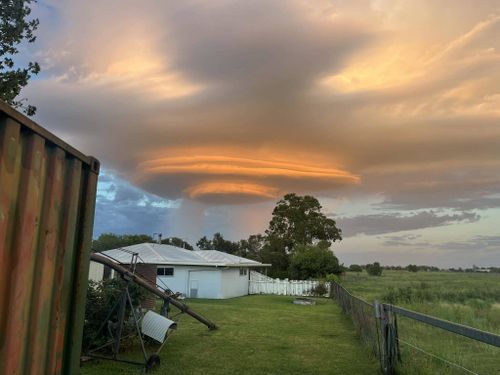
Stormy weather also whipped up some rare cloud formations across the Darling Downs and north of Toowoomba early today.
Known as a lenticular storm cloud, the UFO-like clouds are formed when stable moist air flows over a range of mountains.
The early morning sunrise also lit up the clouds, giving it a glowing look before storms threatened to batter the region.


The severe thunderstorms had eased by 12pm (AEST) however redevelopment of these storms could be possible, particularly around South Burnett.
Toowoomba, Lockyer Valley and the Southern Downs areas were warned of an incoming storm around 6am, which saw a fierce hailstorm batter the regions early today.
There’s a chance of more daily storms impacting inland parts of Queensland tomorrow and over the weekend.
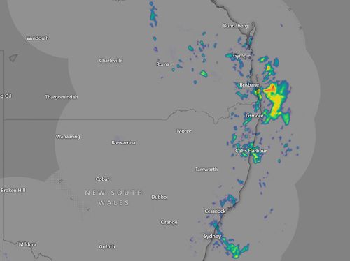
Cleanup also continues in Brisbane and the Gold Coast following a flash downpour overnight, which saw 72mm of rainfall in some areas.
Heavy rain and wild and damaging winds lashed the south-east yesterday and more than 20 call-outs were made to SES overnight.
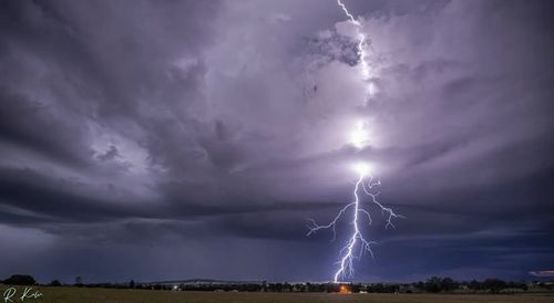
There were well over 117,000 lightning strikes across the region, with Brisbane’s northside hit the hardest.
The city looked cyclonic as wind gusts reaching 80-90km/h whipped through trees and even brought some down at Albany Creek.

Parts of NSW have also copped a rain bomb following an intense early New Year heatwave.
Nearly half a month’s worth of rain soaked Sydney in the past 24 hours and the wet weather is forecast to continue over the next week.
There was 45 mm of rain in the 24 hours to 9am on Thursday, Weatherzone reports.
This rainy trough is expected to roll through NSW and across eastern Australia for the next several days.
Thunderstorms are forecast for the north-east parts of the Northern Tablelands and Northern Rivers, with a chance of severe thunderstorms and heavy rain as the storms slowly move across the east.

Victoria won’t be spared from the storms today, with western Victoria forecast to be hit with some moderate thunderstorms into the afternoon and evening.
Parts of the state are sweating through above-average temperatures, with Mildura reaching tops of 35 degrees today, while Melbourne and Geelong are sitting at around 31 degrees.
:contrast(12):saturation(1.48)/https%3A%2F%2Fprod.static9.net.au%2Ffs%2Fac33da02-4ef0-4bba-9022-8df49cbc6aa2)


